


A severe line of thunderstorms is pounding the Chicago region as it makes its way to the east. South Bend could begin seeing the storms as early as 9:45 pm tonight. Most of Northern Indiana and Southwestern Michigan is currently under a severe thunderstorm watch.
The counties include but are not limited to Benton, Cass, Elkhart, Fulton, Jasper, Kosciusko, Lake, La Porte, Marshall, Miami, Newton, Porter, Pulaski, St. Joseph, and Starke. The National Weather Service currently says that the advisory will expire at 10 pm Eastern Time on June 30.
The biggest threat from a possible derecho, Spanish for “straight”, which is a long and wide area of high straight-line sustained winds. The Weather Channel explains that derechoes can extend tens of miles wide and hundreds miles long. It is not out of the question that winds could approach 50 mph in some places. Tornadoes, hail, and flooding are also possible.
We are getting reports of power outages in the Chicago suburbs of Joliet and Lockport, IL. We will provide updates as more information becomes available.
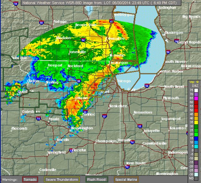
Below is the latest image from the National Weather Service’s radar (as of 7:49 pm):
Follow South Bend Voice on Facebook and Twitter to stay up-to-date on storm information.